บทท่ี 8
สรปุ และขอ้ เสนอแนะ
8.1 บทสรปุ
การศึกษาพื้นที่อ่อนไหวต่อการดินถล่มในพื้นที่จังหวัดพังงา โดยการวิเคราะห์ข้อมูล
ในระบบสารสนเทศภูมิศาสตร์ ด้วยแบบจำลองทางคณิตศาสตร์ด้วยวิธีทางสถิติ bivariate probability
และ weighting พิจารณทั้งจาก 7 ปัจจัยที่เกี่ยวข้องกับการเกิดดินถล่ม ได้แก่ วิทยาหิน หน้ารับน้ำฝน
ระยะห่างจากทางน้ำ ระยะห่างจากโครงสร้างทางธรณีวิทยา ระดับความสูง ความลาดชัน และการใช้
ประโยชนท์ ดี่ ิน สามารถสรปุ ผลจากการวเิ คราะห์ ไดด้ ังนี้
1.) ปัจจัยที่ควบคุมการเกิดดินถล่มในพื้นที่จังหวัดพังงาพบว่ามีความสัมพันธ์กับ
การกระจายตัวของร่องรอยดินถล่ม เรียงลำดับความสำคัญจากมากไปหาน้อย ได้แก่ 1.) ความลาดชัน
2.) วิทยาหิน 3.) การใช้ประโยชน์ที่ดิน 4.) ระดับความสูง 5.) ระยะห่างจากโครงสร้าง 6.) หน้ารับน้ำฝน
และ 7.) ทิศทางการไหลของนำ้ ตามลำดับ
2.) การกะจายตัวของร่องรอยดินถล่ม พบส่วนใหญ่อยู่ในพื้นที่ต้นน้ำบริเวณพื้นที่ป่าที่มี
ต้นไม้ใหญ่ ที่มีความลาดชันตั้งแต่ 50-60 องศา ณ ที่ความสูงตั้งแต่ 1,200-1,400 เมตรจากระดับทะเล
ปานกลาง และสามารถพบในกลุ่มวิทยาหิน หิน SS5 จำพวกหินทรายเนื้ออาร์โคสที่มีกรวดปน
กลุ่มวิทยาหิน FS1 จำพวกหินตะกอนเนื้อละเอียดแทรกสลับหินทรายเนื้อเกรย์แวก กลุ่มวิทยาหิน GR2
จำพวกหินแกรนิตเนื้อผลึกสองขนาดหรือเนื้อดอก และกลุ่มวิทยาหิน CB1 จำพวกหินคาร์บอเนตเนื้อผลึก
และเนอ้ื โดโลไมต์
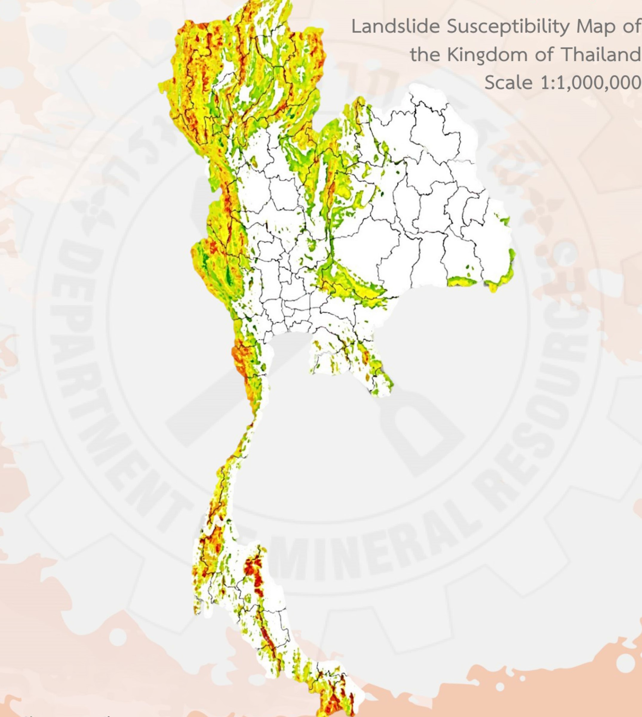
3.) พื้นที่ออ่ นไหวตอ่ การเกดิ ดินถลม่ ในพ้ืนท่จี งั หวดั พงั งา จำแนกออกไดเ้ ป็น 5 ระดับ
(1) ระดับต่ำมาก (very low) ครอบคลุมพื้นที่ประมาณ 149 ตารางกิโลเมตร คิดเป็น
รอ้ ยละ 6.02 ของพน้ื ทอ่ี อ่ นไหวตอ่ การเกิดดินถล่มท้งั หมด
(2) ระดับต่ำ (low) ครอบคลุมพื้นที่ประมาณ 1,145 ตารางกิโลเมตร คิดเป็นร้อยละ
46.18 ของพื้นทีอ่ อ่ นไหวต่อการเกดิ ดนิ ถลม่ ทัง้ หมด
(3) ระดับปานกลาง (moderate) ครอบคลุมพื้นที่ประมาณ 873 ตารางกิโลเมตร คิดเป็น
รอ้ ยละ 35.18 ของพื้นทอ่ี ่อนไหวตอ่ การเกดิ ดินถลม่ ท้ังหมด
(4) ระดับสูง (high) ครอบคลุมพื้นที่ประมาณ 226 ตารางกิโลเมตร คิดเป็นร้อยละ 9.13
ของพนื้ ที่อ่อนไหวตอ่ การเกดิ ดนิ ถลม่ ทัง้ หมด
(5) ระดับสูงมาก (very high) ครอบคลุมพื้นที่ประมาณ 87 ตารางกิโลเมตร คิดเป็น
ร้อยละ 3.49 ของพ้ืนที่อ่อนไหวต่อการเกดิ ดินถลม่ ทัง้ หมด
- 220 -
4.) การทดสอบคุณสมบัติทางกายภาพของดินขั้นพื้นฐาน สามารถจำแนกประเภทของ
ดินออกเป็นทั้งหมด 6 กลมุ่ ดังน้ี
(1) ดินกลุม SM (silty sands) คือ ดินพวกเม็ดหยาบเป็นดินในกลุมทรายเม็ดละเอียด
ปนทราย มีตะกอนทรายปน ทราย-ตะกอนทรายผสมกัน ขนาดคละกันดี พบกระจายตัวในพื้นที่หินฐาน
เป็นหินไบโอไทต์แกรนิต ในกลุ่มวิทยาหิน GR1 หินแกรนิต หินแกรนิตเนื้อดอก หินไบโอไทต์แกรนิตเนื้อ
ดอก หินไบโอไทต์-มัสโคไวตแ์ กรนติ หินไบโอไทต์ ในกลุ่มวทิ ยาหิน GR2
(2) ดินกลุม SC (clayey sands) คือ ดินพวกเม็ดหยาบเป็นดินในกลุมทรายเม็ดละเอียดปน
ทราย มีเศษดินเหนียวปน ทราย-ดินเหนียวผสมกัน ขนาดคละกันไม่ดี พบกระจายตัวในพื้นที่ หินฐานเป็น
หินทัวร์มาลีน-มัสโคไวต์แกรนิต หินแกรนิต หินแกรนิตเนื้อดอก หินไซยาโนแกรนิต หินไบโอไทต์-มัสโคไวต์
แกรนิต ในกล่มุ วิทยาหิน GR2 และหินฐานเปน็ หนิ ไบโอไทตแ์ กรนิตเนื้อดอก ในกล่มุ วทิ ยาหนิ GR1
(3) ดินกลุม MH (inorganic silts) คือ ดินพวกเม็ดละเอียดเป็นดินกลุ่มตะกอนทราย
อนินทรีย์และทรายละเอียดหรือตะกอนทรายปนไมก้าหรือดินเบา ตะกอนทรายที่ยืดหยุ่น พบกระจายตัว
ในพื้นที่ หินฐานเป็นหินทรายแป้งปนกรวด หินทรายแป้ง กึ่งแปรสภาพ ในกลุ่มวิทยาหิน FS1 หินทราย
เนื้อละเอียด หินโคลน ในกลุ่มวิทยาหิน FS2 หินทรายเนื้อปานกลางกึ่งแปรสภาพ ในกลุ่มวิทยาหิน CT
หินฐานเป็นหินไบโอไทต์แกรนิต ในกลุ่มวิทยาหิน GR1 หินทรายปนกรวดเนื้อละเอียดถึงปานกลาง
หินทรายแป้งปนกรวด ในกลุ่มวิทยาหิน SS3 และหินฐานเป็นหินโดโลไมต์แสดงชั้นหนาปานกลางถึง
ชน้ั หนา ในกลุม่ วทิ ยาหิน CB1
(4) ดินกลมุ ML (inorganic silts and very fine sand) คอื ดินพวกเมด็ ละเอยี ดเปน็ ดนิ
ในกลุมตะกอนทรายอนินทรีย์และทรายละเอียดมากหนิ ฝุ่นทรายละเอยี ดปนตะกอนทรายหรือดินเหนยี วมี
ความเหนียวเล็กนอ้ ย พบกระจายตัวในพื้นที่ หินฐานเป็นหินทรายแป้งปนกรวดกึ่งแปรสภาพ หินทรายปน
กรวด ในกลุ่มวิทยาหิน SS3 หินฐานเป็นหินทรายแป้งกึ่งแปรสภาพ ในกลุ่มวิทยาหิน FS1 หินฐานเป็นหิน
ทรายเนอื้ ละเอียดถงึ ปานกลาง ในกล่มุ วทิ ยาหิน SS2
(5) ดินกลุม CH (clay of high plastic) คือ ดินพวกเม็ดละเอียดเป็นดินในกลุ่มดิน
เหนยี ว อนนิ ทรยี ์มคี วามเหนียวสูง ดนิ เหนียวมีความหนดื สูง พบกระจายตัวในพน้ื ท่ี หินฐานเปน็ หินแกรนิต
ผลึกละเอียดแสดงการเรียงตัวของแร่ ในกลุ่มวิทยาหิน GR1 หินฐานเป็นหินแกรนิต หินไบโอไทต์แกรนิต
เนื้อดอก ในกลุ่มวิทยาหิน GR2 หินฐานเป็นหินทรายแป้งปนกรวด หินทรายปนกรวดเนื้อละเอียดถึงปาน
กลาง หนิ ทรายแปง้ ปนกรวดก่งึ แปรสภาพ ในกลุม่ วทิ ยาหิน SS3
(6) ดินกลุม CL (clay of low to medium plasticity) คือ ดินพวกเม็ดละเอียดเป็น
ดินในกลุม่ ดินเหนยี วอนินทรีย์ มคี วามเหนยี วตำ่ -ปานกลาง ดนิ เหนยี วปนทราย ดนิ เหนียวปนตะกอนทราย
พบกระจายตัวในพื้นที่ หินฐานเป็นหินโคลนปนกรวด ในกลุ่มวิทยาหิน FS1 หินฐานเป็นหินทรายเนื้อ
ละเอียดถึงปานกลาง หินทรายเนื้อละเอียดมากถึงละเอียด หินทรายแป้ง ในกลุ่มวิทยาหิน FS2 หินฐาน
- 221 -
เป็นหนิ ทรายปนกรวดเนือ้ ละเอียดถึงปานกลาง เปน็ หนิ ทรายแปง้ ปนกรวดกงึ่ แปรสภาพ หินทรายปนกรวด
ในกลุ่มวิทยาหนิ SS3
8.2 ขอ้ เสนอแนะ
1.) การศึกษาหาแนวทางเพื่อวิเคราะห์พื้นที่อ่อนไหวต่อการเกิดดินถล่มให้ทันสมัยและเป็น
ปัจจุบันนัน้ ต้องอาศัยข้อมลู ท่ีมกี ารปรบั ปรงุ แก้ไขอยู่เสมอ จงึ จะเกิดความถูกตอ้ งของแบบจำลองมากทส่ี ดุ
2.) ข้อมลู ที่นำมาใช้ในการวเิ คราะหต์ ้องทมี่ ีความถกู ตอ้ ง ควรมกี ารจัดเก็บฐานข้อมูลให้อยู่ใน
รูปแบบของระบบสารสนเทศภูมิศาสตร์ เพื่อให้ง่ายต่อการใช้งานและการปรับปรุง เปลี่ยนแปลง แก้ไข
ข้อมลู ให้มคี วามเปน็ ปัจจบุ นั และถกู ตอ้ งมากท่สี ุด
3.) การใช้ภาพถ่ายดาวเทียมที่มีความละเอียดสูง และการออกภาคสนามเพื่อเก็บข้อมูลทั้ง
ข้อมูลด้านธรณวี ทิ ยาและข้อมูลร่องรอยดินถล่มควบคู่กัน จะทำใหไ้ ดข้ ้อมลู ที่ถูกต้อง และทำให้การทำแผน
ทร่ี อ่ งรอยดินถล่มและแผนที่พ้นื ท่ีอ่อนไหวตอ่ การเกิดดนิ ถล่มมคี วามถูกต้อง แมน่ ยำมากย่งิ ขน้ึ
4.) การทำรายละเอียดของการใช้ประโยชน์ของพื้นที่อาจจะช่วยในการอธิบาย
การเปล่ียนแปลงของสภาพแวดล้อมทีม่ ผี ลตอ่ การเกดิ ดนิ ถล่มได้
เอกสารอ้างองิ
กรมทรพั ยากรธรณี, 2550, การศกึ ษาคาบอุบตั ซิ ำ้ ในพน้ื ทท่ี ีแ่ สดงรอ่ ยรอยการเคล่ือนตวั ของรอยเลือ่ นในจังหวดั ประจวบคีรขี ันธ์ ชมุ พร ระนอง
สุราษฎร์ธานี กระบ่ี พงั งา และภูเกต็ (รอยเลอ่ื นระนองและรอยเลื่อนคลองมะรุ่ย), กองธรณวี ทิ ยาส่งิ แวดล้อม, กรมทรัพยากรธรณี, กระทรวง
ทรัพยากรธรรมชาตแิ ละสง่ิ แวดลอ้ ม.
กรมทรพั ยากรธรณี, 2556, การจำแนกเขตเพือ่ การจดั การดา้ นธรณวี ทิ ยาและทรัพยากรธรณี จงั หวดั พงั งา: กรงุ เทพฯ, กรมทรพั ยากรธรณี
กระทรวงทรพั ยากรธรรมชาตแิ ละส่งิ แวดลอ้ ม, 121 หน้า.
_______________, 2550ข, ธรณวี ทิ ยาประเทศไทย (พมิ พ์ครง้ั ที่ 2 ฉบับปรบั ปรงุ ): กรุงเทพฯ กรมทรพั ยากรธรณี, 628 หนา้ .
กรมโยธาธิการและผังเมือง, 2562, มาตรฐานประกอบการปฏบิ ัติเพอื่ ความปลอดภัยที่เกย่ี วข้องกับอาคาร การขดุ ดนิ และการถมดิน
ในพน้ื ทเ่ี สีย่ งภัยดนิ ถล่ม (Landslide) และบริเวณลาดเชิงเขา, กรมโยธาธกิ ารและผงั เมอื ง, กระทรวงมหาดไทย, 107 หนา้ .
_______________, 2556, แผนทีธ่ รณีวิทยา ฉบบั พกพา มาตราสว่ น 1:1,000,000 (Geological map of Thailand, scale
1:1,000,000): กรุงเทพฯ กรมทรพั ยากรธรณี กระทรวงทรพั ยากรธรรมชาติและส่ิงแวดล้อม.
กรมอตุ นุ ิยมวทิ ยา, 2563, ภมู อิ ากาศจงั หวัดพงั งา[online]. สบื ค้นจาก http://climate.tmd.go.th/data/province/ใต้ฝัง่
ตะวนั ตก/ภูมอิ ากาศจังหวัดพงั งา.pdf [20 มกราคม 2565]
กรมอตุ นุ ิยมวทิ ยา, 2565, หนงั สืออตุ ุนิยมวิทยา พายหุ มุนเขตร้อน ลมมรสุม[online]. สบื ค้นจาก
https://www.tmd.go.th/info/info.php?FileID=58 [24 มนี าคม 2565]
คณะทรพั ยากรธรรมชาติ มหาวิทยาลยั สงขลานครินทร์, 2540, การจดั การสาธารณภยั ในภาคใต้ของประเทศไทย (สงขลา):
คณะทรัพยากรธรรมชาติ มหาวทิ ยาลัยสงขลานครินทร์.
เฉลิมพร กาญจนสถติ ย์, 2556, แผนทธี่ รณีวิทยาจงั หวัดพังงา. กรมทรพั ยากรธรณี.
ชศู ักดิ์ ครี รี ตั น์, 2554, ปฐพีกลศาสตร์: กรุงเทพฯ, ท้อป, 813 หนา้ .
นิพนธ์ ตัง้ ธรรม และปรีชา คูรตั น์, 2516, ดนิ เลื่อนไหลในป่าดบิ เขาดอยปุย เชยี งใหม่ การวจิ ัยล่มุ นำ้ ห้วยคอกม้า 16 ตุลาคม 2516:
มหาวิทยาลยั เกษตรศาสตร์ คณะวนศาสตร์ ภาควชิ าอนุรักษวิทยา.
นิวัติ เรอื งพานชิ , 2513, ความสัมพนั ธร์ ะหวา่ งปรมิ าณฝนและลกั ษณะการไหลของนำ้ ในลำธาร ลมุ่ นำ้ หว้ ยคอกม้า ดอยปุย
จังหวัดเชียงใหม่: กรุงเทพฯ, การวิจยั ลมุ่ น้ำคอกม้า เลม่ ที่ 6 วิชาอนุรกั ษว์ ทิ ยา คณะวนศาสตร์ มหาวทิ ยาลัยเกษตรศาสตร.์
บริษทั เว็บสวัสดี จำกดั (มหาชน), 2560, ขอ้ มลู การเดนิ ทางไปจังหวดั จนั ทบรุ ี, บรษิ ทั เวบ็ สวสั ดี จำกัด (มหาชน) [Online]: แหลง่ ทม่ี า:
http://www.sawadee.co.th/thai/chantaburi/transportation.html [2563, กุมภาพนั ธ์ 22]
ปริญญา นุตาลัย และวนั ชัย โสภณสกุลรัตน,์ 2532, การปอ้ งกันอุทกภยั ภาคใต้: เอกสารประกอบการสัมมนา เลม่ ท่ี 1 วนั ที่ 17-18
สงิ หาคม 2532 โรงแรมเจบี หาดใหญ่ สงขลา, 34 หนา้ .
พิสทุ ธิ์ วจิ ารสรณ์ สรุ นิ ทร์ ไวยเจริญ สถริ ะ อุดมศรี อนวุ ตั ร โพธมิ าน และสุพร บญุ ประคบั , 2533, รายงานการศึกษาสาเหตแุ ละ
การประเมินความเสียหายบรเิ วณพ้ืนท่ีอุทกภยั ของจังหวดั นครศรธี รรมราช และสรุ าษฎรธ์ านี ในสว่ นที่เก่ยี วขอ้ งกบั ลักษณะ
ดนิ และธรณีวทิ ยา: กรุงเทพฯ, กองสำรวจดนิ และจำแนกดนิ กรมพัฒนาทีด่ ินและสหกรณ์.
พงศ์พจน์ เจียมตน, 2539, ธรณีวิทยาจังหวดั พงั งา, เอกสารวขิ าการเลม่ ที่ 9/2539, สำนกั งานทรพั ยากรธรณเี ขต 2 (ภูเกต็ ), กรม
ทรพั ยากรธรณี.
พล เชาวด์ ำรง, 2553, ลำดบั ชน้ั หินของกลมุ่ หินแกง่ กระจาน: ปรับปรงุ ใหม่. กรุงเทพ, สำนักธรณวี ิทยา กรมทรัพยากรธรณี, 172
หน้า.
เพียงตา สาตรกั ษ์, 2559, ธรณวี ทิ ยาโครงสรา้ ง structural geology, ภาควชิ าเทคโนโลยีธรณี คณะเทคโนโลยี
มหาวทิ ยาลัยขอนแก่น, 555 หนา้ .
มณเฑียร กงั ศศเิ ทยี ม, 2543, กลศาสตร์ของดนิ ด้านวิศวกรรม: กรงุ เทพฯ, บรษิ ทั อมั รนิ ทรพ์ รนิ้ ตงิ้ แอนด์ พบั ลิชช่งิ จำกดั ,
371 หนา้ .
- 224 -
เมธา ศรที องคำ, 2561, การศึกษาลกั ษณะและสมบตั ขิ องดินท่มี วี ตั ถุต้นกำเนิดจากหนิ แกรนติ บรเิ วณจังหวัดอทุ ัยธานี: กรงุ เทพฯ,
กลุ่มสำรวจจำแนกดนิ กองสำรวจและวิจัยทรัพยากรดนิ กรมพฒั นาทด่ี ิน กระทรงเกษตรและสหกรณ,์ 151 หนา้ .
ราชบณั ฑติ ยสถาน. (2544). พจนานกุ รมศพั ท์ธรณีวทิ ยา ฉบบั ราชบณั ฑิตยสถาน. กรงุ เทพฯ: ราชบณั ฑติ ยสถาน, 384 หนา้ .
เลิศสิน รกั ษาสกุลวงษ์, 2545, กล่มุ หนิ ทุ่งใหญ่: หินตะกอนสะสมตวั บรเิ วณรอยตอ่ ภาคพน้ื สมุทรและภาคพนื้ ทวปี ยคุ จแู รสซิก – ครี
เทเชยี ส บริเวณภาคใตข้ องประเทศไทย. กองธรณวี ิทยา กรมทรพั ยากรธรณี, 49 หนา้ .
สันต์ อัศวพัชระ และ พล เชาวด์ ำรง, 2554, ลำดับชนั้ หนิ ของกลุม่ หนิ ราชบรุ ี, ส่วนมาตรฐานธรณวี ทิ ยา สำนักธรณวี ิทยา
กรมทรัพยากรธรณี.
สำนักงานโครงการพัฒนาแหง่ สหประชาชาติ (UNDP), 2559, คมู่ ือการประเมนิ ความเสย่ี งจากภยั พบิ ัติ: กรงุ เทพฯ, สำนักงาน
โครงการพัฒนาแห่งสหประชาชาติ สำนกั งานประเทศไทย.
ศูนย์วิจัยป่าไม้, 2537, รายงานฉบบั สุดท้ายโครงการศกึ ษาเพื่อกำหนดพืน้ ท่ีเสี่ยงตอ่ การเกิดอุทกภัยและภยั ธรรมชาติในพ้นื ทล่ี มุ่ นำ้
ภาคใต้: กรงุ เทพฯ, สำนักงานกองทนุ สนับสนุนการวิจยั .
ศศิวมิ ล นววธิ ไพสฐิ , 2551, รายงานการวเิ คราะห์พืน้ ท่เี สยี่ งภัยดนิ ถลม่ จงั หวดั พังงา: รายงานวชิ าการ, กองธรณวี ิทยาสิง่ แวดลอ้ ม,
กรมทรพั ยากรธรณ,ี ฉบบั ท่ี กธส 7/2551, 76 หน้า.
วรวุฒิ ตนั ติวานิช, 2535, ธรณวี ิทยาภยั พบิ ตั ิ เนอ่ื งจากแผ่นดินถล่มท่ีบา้ นกระทูนเหนอื จงั หวดั นครศรธี รรมราช: รายงานวชิ าการ,
กองธรณีวทิ ยา, กรมทรัพยากรธรณี, ฉบบั ท่ี 1, 30 หนา้ .
สถาบนั สารสนเทศทรพั ยากรนำ้ และการเกษตร (องคก์ ารมหาชน), 2561, [Online]: แหลง่ ทีม่ า:
http://www.thaiwater.net/current/YearlyReport2018/rain.html [2563, กมุ ภาพนั ธ์ 22]
Akgün, A., and Bulut, F., 2007, "GIS-based landslide susceptibility for Arsin-Yomra (Trabzon, North Turkey)
region: Environmental geology, v. 51, no. 8, p.1377-1387.
Anbalagan, R., 1992, Landslide hazard evaluation and zonation mapping in mountainous terrain: Engineering.
Geology., v. 32, p.269-277.
Anonymous, (n.d). Retrieved January 6, 2021, from
http://nfile.snru.ac.th/download.aspx?cv=1&NFILE=TEACHER_157_12082015220052848.pdf
Aleotti, P., and Chowdhury, R., 1999, Landslide hazard assessment: summary review and new perspectives:
Bulletin of Engineering Geology and the Environment, v. 58, no. 1, p.21-44.
Axel Volkwein, 2014, Flexible debris flow barriers Design and application, WSL Berichte ISSN 2296-3456.
Ayalew, L., and Yamagishi, H., 2005, The application of GIS-based logistic regression for landslide susceptibility
mapping in the Kakuda-Yahiko Mountains: Central Japan, v. 65, no. 1–2, p.15-31.
ASTM, 2000, Standard Test Methods for Liquid Limit, Plastic Limit, and Plasticity Index of Soils - D4318-84: West
Conshohocken, Pennsylvania, USA, ASTM International, p.14.
______________, 2000, Standard Test Method for Particle Size Analysis of Soils - D422-63: West
Conshohocken, Pennsylvania, USA, ASTM International, p.8.
______________, 2000, Standard Test Methods for Specific Gravity of Soil Solids by Water Pycnometer - D854-
02: West Conshohocken, Pennsylvania, USA, ASTM International, p.7.
Bunopas, S., 1981, Paleogeographic history of western Thailand and adjacent parts of Southeast Asia – A plate
tectonics interpretation: Victoria University of Willington, unpublished Ph.D. thesis, 810 p.; reprinted 1982
as Geological Survey Paper no.5, Geological Survey Division, Department of Mineral Resources, Thailand.
Carrara, A., and R., Pike, 2008, GIS technology and models for assessing landslide hazard and risk:
Geomorphology (Amsterdam), v. 94. p.3-4.
- 225 -
Cardinali, M., Reichenbach, P., Guzzetti, F., Ardizzone, F., Antonini, G., and Galli, M., 2002, A geomorphological
approach to the estimation of landslide hazards and risks in Umbria, Central Italy: Natural Hazards and
Earth System Sciences, v. 2, p.57-7.
Cevik, E., and T., Topal, 2003, GIS-based landslide susceptibility mapping for a problematic segment of the
natural gas pipeline, Hendek (Turkey): Environmental geology, v. 44, no. 8, p.949-962.
Chung, C. F., and Fabbri, A. G., 2003, Validation of spatial prediction models for landslide hazard mapping:
Natural Hazards v. 30, no. 3, p.451-472.
Craig, R. F., 2004, Craig's soil mechanics (7th ed.): Taylor & Francis, 464 p.
Cruden, D., and Varnes, D., 1996, ‘Landslide Types and Processes’, In S. R. Turner (ed) Landslides Investigation
and Mitigation: Transportation research board national research council, Special Report, v. 247, p.36–75.
Dahal, R., Hasegawa, S., Nonomura, A., Yamanaka, M., Dhakal, S., and Paudyal, P., 2008, Predictive modelling
of rainfall-induced landslide hazard in the Lesser Himalaya of Nepal based on weights-of-evidence:
Geomorphology, v. 102, no. 3-4, p.496-510.
_______________, Hasegawa, S., Nonomura, A., Yamanaka, M., Masuda, T., and Nishino, K., 2008, GIS-based
weights-of-evidence modelling of rainfall-induced landslides in small catchments for landslide
susceptibility mapping: Environmental Geology, v. 54, no. 2, p.311-324.
_______________, Hasegawa, S., Nonomura, A., Yamanaka, M., Masuda, T., and Nishino, K., 2008, GIS-based
weights-of-evidence modelling of rainfall-induced landslides in small catchments for landslide
susceptibility mapping: Environmental Geology, v. 54, no. 2, p.311-324.
Dai, F. C., and Lee, C. F., 2001, Terrain-based mapping of landslide susceptibility using a geographical
information system: a case study: Canadian Geotechnical Journal, v.38, no.5, p.911-923.
_______________, 2002, Landslide characteristics and slope instability modelling using GIS, Lantau Island Hong
Kong: Geomorphology, v. 42, no. 3–4, p.213-228.
Dearman, W.R., 1974, Weathering classification in the characterisation of rock for engineering purposes in
British practice: Bulletin of the International Association of Engineering Geology, v.9, p.33-42.
______________, 1976, Weathering classification in the characterisation of rock - A revision: Bulletin of the
International Association of Engineering Geology, v.13, p.123-127.
______________, 1991, Engineering geological mapping. Butterworth-Heinemann, 396 p.
Ercanoglu, M., and Gokceoglu, C., 2004, Use of fuzzy relations to produce landslide susceptibility map of a
landslide prone area (West Black Sea Region, Turkey): Engineering Geology, v. 75, no. 3-4, 229-250.
Ermini, L., Catani, F., and Casagli, N., 2005, Artificial Neural Networks applied to landslide susceptibility
assessment: Geomorphology, v. 66, no. 1-4, p.327-343.
Garson, MS., Mitchell AHG., and Trit AR., 1975, The Geology of the Phuket - Phangnga Area in Peninsula,
Thailand: London, HMSO.
Guzzetti, F., Carrara, A., Cardinali, M., and Reichenbach, P., 1999, Landslide hazard evaluation: a review of
current techniques and their application in a multi-scale study: Central Italy, Geomorphology, v. 31, no.
1-4, p.181-216.
Hasanat, M. H. A., Ramachandram, Dhanesh and Rajeswari, 2010, Bayesian belief network learning algorithms
for modeling contextual relationships in natural imagery: a comparative study: Artificial Intelligence
Review, v. 34, no. 4, p.291-308.
- 226 -
He, Y., and Beighley, R. E., 2008, GIS-based regional landslide susceptibility mapping: a case study in southern
California: Earth Surface Process and Landforms, v. 33, p.380–393.
Hewlett, J. D., and Hibbert, A. R., 1967, Factors affecting the response of small watersheds to precipitation in
humid areas: Forest hydrology, v. 1, p.275-290.
Hearn, G. J., 2016, A3 Slope materials, landslide cause and landslide mechanisms. Engineering Geology Special
Publications, v.24, p.15-57.
Hillel, D., 2008, Soil in the Environment, Academic Press, p.15-26.
Hoover, M. D., and Hursh, 1943, Influence of topography and soil‐depth on runoff from forest land: Eos.
Transactions American Geophysical Union, v. 24, no. 2, p. 693-698.
_______________, 1950, Hydrologic characteristics of South Carolina piedmont forest soil: Soil Science Society
of America Proceedings, v. 14, p. 353-358.
Hornbeck, J. W., and K.G. Reinhart, 1964, Water Quality and Soil Erosion as Affected in Steep Terrain: Journal
of Soil and Water Conservation, v. 19, no. 1, p.23-27.
Khampilang, N., 2015, Landslide assessment in a remote mountain region: a case study from the Toktogul
region of Kyrgyzstan: Central Asia, Ph.D. Thesis, University of Portsmouth.
Kingbury, A.P., Hastie, J.W., and Harrington, A.J., 1991, Reginal landslip hazard assessment using a Geographic
Information System, In D., H., Bell, ed., landslides Glissements de terrain. Edited: Geology Department,
Univ. of Canterbury, Christchurch New Zealand: Balkerma, Rotterdam: Rotterdam, p.995–1,000.
Lessing, P., Messenia, C. P., and Fonner, R. F., 1983, Landslides risk assessment: Environmental Geology,
v. 5, no. 2, p.93-99.
Malamud, B. D., Turcotte, D. L., Guzzetti, F., and Reichenbach, P., 2004, Landslide inventories and their
statistical properties: Earth Surface Processes and Landforms, v. 29, no. 6, p.687-711.
Matsukura, Y., and Tanaka, Y., 1983, Stability analysis for soil slips of two gruss-slopes in Southern Abukuma
Mountains: Japan. Trans. Japan.
Mehrotra, G. S., Sarkar, S., and Dhamaraju, R., 1991, Landslide hazard assessment in Rishikeshtehri Area,
Garhwal Himalaya, India, In D. H. Bell, ed., Landslides Glissement De Terrain: Geology Department,
University of Canterbury, Christchurch, New Zealand.
Miller, S., 2007, Geographical Information Systems (GIS) applied to Landslide Hazard Mapping and Evaluationin
North-East Wales: Liverpool, University of Liverpool.
Nakapadungrat, S., Beckinsale, R.D., and Suensilpong, S., 1984, Geochronology and geology of Thai granites:
Conference on Application of Geology and the National Development, Chulalongkorn University,
Bangkok, November, v. 19–22, p.75–93.
Nandi, A., and Shakoor, A., 2010, A GIS-based landslide susceptibility evaluation using bivariate and
multivariate statistical analyses: Engineering Geology, v. 110, no. 1- 2, p.11-20.
Nawawitphisit, S., 2010, Using GIS and remote sensing techniques to predict landslides in Southwest
Guatemala: M.Sc. Dissertation, University of Bristol.
Neuhäuser, B., and Terhorst, B., 2007, Landslide susceptibility assessment using “weights-of-evidence” applied
to a study area at the Jurassic escarpment (SW-Germany): Geomorphology v. 86, no. 1-2, p.12-24.
Okagbue, C. O., 1989, Predicting landslips caused by rainstorms in residual/colluvial soil of Nigerian hillside
slopes: Natural Hazards, v. 2, p.133–141.
- 227 -
Ohlmacher, G. C., and Davis, J. C., 2003, Using multiple logistic regression and GIS technology to predict
landslide hazard in northeast Kansas USA: Engineering Geology, v. 69, no. 3–4, p.331-343.
Park, N. W. and Chi K. H., 2008, Quantitative assessment of landslide susceptibility using high‐resolution
remote sensing data and a generalized additive model: International Journal of Remote Sensing,
v. 29, no. 1, p. 247-264.
Pradhan, B., and Lee, S., 2010, Delineation of landslide hazard areas on Penang Island, Malaysia, by using
frequency ratio, logistic regression, and artificial neural network models: Environmental Earth Sciences, v.
60, no. 5, p.1037-1054.
Putthapiban, P., 1984, Geochemistry, Geochronology and tin mineralization of Phuket granites, Phuket,
Thailand: unpublished Ph.D. thesis, La Trobe University Victoria, Australia, 421 p.
Nianxueo, Z., and S., Zhupingo, 1992, Probability analysis of rain-related occurrence and revival of landslides
in Yunyang-Fengjie area in East Sichuan. International symposium on landslides.
Nwajide, C. S., Okagbue, C. O., and Umeji, A. C., 1988, Slump-debris flows in the Akovolwo mountains area of
Benue State, Nigeria: Natural Hazards, v. 1, p.145–154.
Regmi, K.., Naidoo, J., and Pilkinng, P., 2010, Understanding the processes of translation and transliteration in
qualitative research: International Journal of Qualitative Methods, v., 9, no. 1,
p.16-26.
Rice, R. M., and Foggin, G. T., 1971, Effects of high intensity storms in soil slippage on mountainous water-
sheds in southern California: Water Resource Research, v., 7, no. 6, p.1485–1496.
Selby, M.E., 1993, Hillslope materials and processes. Oxford University Press, Oxford.
Serizawa, M., 1981, On runoff phenomena during a storm in a small basin of uppermost reach of River
Yamaguchi. Hydrology, v. 11, p.8-15.
Soeters, R., and van Westen, C. J., 1996, Slope instability recognition, analysis, and zonation: Washington, DC,
Transportation Research Board.
Suzen, M., and Doyuran, V., 2004, Data driven bivariate landslide susceptibility assessment using geographical
information systems: a method and application to Asarsuyu catchment; Turkey: Engineering Geology, v.
71, p.303-321.
Tangtham, N., 1999, Observed and hypothetical effect over time of the terraced forest plantation on soil and
water losses at Doi Angkhang highland project: Chiang Mai.
Teerarungsigul, S., 2006, Landslide prediction model using remote sensing, GIS and field geology: a case study
of Wang Chin district, Phrae province, Northern Thailand: Suranaree University of Technology, Nakhon
Ratchasima, 190 p.
Thiery, Y., Malet, J. P., Sterlacchini, S., Puissant, A., and Maquaire, O., 2007, Landslide susceptibility assessment
by bivariate methods at large scales: Application to a complex mountainous environment:
Geomorphology, v. 92, no. 1-2, p.38-59.
Trimble, G. R., Hale C. E., and Potter, H. S., 1951, Effect of Soil Cover Condition on Soil-Water Relationhips:
Station Paper NE-39. Upper Darby, PA: U.S. Department of Agriculture, Forest Service, Northeastern Forest
Experiment Station, 44 p.
Tsukamoto, Y., 1966, Raindrops under forest canopies and splash erosion: Bull Tokyo Univ Agri Tech For, v. 5,
p. 65-74.
- 228 -
UNISDR., 2004, Living with Risk: A global review of disaster reduction initiatives Neneva: United Nations,
v. 1.
Van Den Eeckhaut, Vanwalleghem, M., Peosen, T., Govers, J., Verstraeten, G., Vandekerckhove, G., and
Liesbeth, 2006, Prediction of landslide susceptibility using rare events logistic regression: a case-study in
the Flemish Ardennes (Belgium): Geomorphology, v. 76, no. 3-4, p.392-410.
Van Westen, C. J., Castellanos, E., and Kuriakose, S. L., 2008, Spatial data for landslide susceptibility, hazard,
and vulnerability assessment: An overview, Engineering Geology, v. 102, no. 3–4, p.112-131.
_______________, Quan Luna, B., Vargas Franco, R., Malet, J. P., Jaboyedoff, M., Horton, P., and Kappes, M.,
2010, Development of training materials on the use of Geo-information for Multi-Hazard Risk Assessment
in a Mountainous Environment, in Proceedings of the Mountain Risks International Conference: Firenze,
Italy, 24–26 November 2010, p.469–475.
Varnes, D.J., 1978, Slope movement types and processes: Landslides analysis and control special report 176.
National Academy of Sciences.
_______________, 1984, Landslide Hazard Zonation: a review of principles and practice: UNESCO, Darantiere,
Paris, 61 p.
Wichai Pantanahiran, 1994, The use of landsat imaery and digital terrain models to assess and predict
landslide activity in tropical areas: a dissertation submitted in partial fulfillment of the requirments for
the degree of doctor of philosophy in natural resources, University of Rhode Island, 56 p.
Xiaohua Bao, Wenyu Liao, Zhijun Dong, Shanyong Wang and Waiching Tang, 2017, Devrlopment of
Vetgetation-Previous Concrete in Grid Beam System for Soil Slope Protecttion, Multidisciplinary Digital
Publishing Institute. 16 p.
Yalcin, A., 2008, GIS-based landslide susceptibility mapping using analytical hierarchy process and bivariate
statistics in Ardesen (Turkey): Comparisons of results and confirmations: Catena, v. 72, no. 1, p.1-12.
_______________, Reis, S., Aydinoglu, A. C., and Yomralioglu, T., 2011, A GIS-based comparative study of
frequency ratio, analytical hierarchy process, bivariate statistics and logistics regression methods for
landslide susceptibility mapping in Trabzon, NE Turkey: Catena, v. 85, no. 3, p.274-287.
Yesilnacar, E., and Topal, T., 2005, Landslide susceptibility mapping: A comparison of logistic regression and
neural networks methods in a medium scale study, Hendek region (Turkey): Engineering Geology, v. 79,
no. 3-4, p.251-266.
Yilmaz, I., 2009, Landslide susceptibility mapping using frequency ratio, logistic regression, artificial neural
networks and their comparison: a case study from Kat landslides (Tokat—Turkey): Computers &
Geosciences, v. 35, no. 6, p.1125-1138.
229
คณะทำงาน นกั ธรณวี ทิ ยาชาํ นาญการพิเศษ กองธรณวี ิทยาส่ิงแวดลอม
นกั ธรณีวทิ ยาชาํ นาญการ กองธรณวี ิทยาสิง่ แวดลอม
นางสาวศศวิ มิ ล นววธิ ไพสฐิ นักธรณีวิทยาชํานาญการ กองธรณวี ิทยาส่งิ แวดลอม
นายสุรเชษฐ รวมธรรม นกั ธรณวี ทิ ยาปฏบิ ตั กิ าร กองธรณวี ิทยาสิ่งแวดลอม
นางรชนชิ ล ยี่สารพัฒน นักธรณวี ทิ ยา กองธรณวี ทิ ยาสิ่งแวดลอม
นางสาวมธุลดา ขดั ทะเสมา นกั ธรณีวิทยา กองธรณีวิทยาสิ่งแวดลอม
นางสาวบญุ นาค โมกศริ ิ พนักงานจ้างเหมาบรกิ าร กองธรณีวทิ ยาสิ่งแวดลอม
นางสาวเปมนัทธ์ ปรางเลิศ พนักงานจา้ งเหมาบรกิ าร กองธรณีวทิ ยาสงิ่ แวดลอม
นายธนบรู ณ์ ชโิ นเรศโยธิน พนกั งานจา้ งเหมาบรกิ าร กองธรณวี ิทยาสิ่งแวดลอม
นายธนวฒั น์ ประเสรฐิ ศริ ิ พนักงานจา้ งเหมาบริการ กองธรณวี ทิ ยาส่ิงแวดลอม
นางสาวปพิชกานต์ ไชยสีหา นกั ธรณีวทิ ยาชำนาญการพิเศษ สำนักงานทรพั ยากรธรณีเขต 1
นายชโลธร ชศู ริ ิ นกั ธรณีวิทยาชำนาญการ สำนกั งานทรพั ยากรธรณเี ขต 1
นางสาวน้ำฝน คำพิลงั นักธรณีวิทยาชำนาญการ สำนักงานทรพั ยากรธรณีเขต 1
นายภคั พงษ์ ศรบี ัวทอง นกั วิชาการทรพั ยากรธรณีปฏิบัติการ สำนกั งานทรัพยากรธรณเี ขต 1
นางสาวทศั นพร เรือนสอน นกั ธรณีวทิ ยา สำนกั งานทรัพยากรธรณีเขต 1
นายธรี ะชยั หนอ่ คำบตุ ร นักธรณีวิทยาชาํ นาญการ สำนักงานทรพั ยากรธรณี เขต 3
นายฐากูร มากคณุ นกั ธรณวี ทิ ยาชาํ นาญการ สำนกั งานทรัพยากรธรณี เขต 3
นางสาวเนาวรตั น์ ปรน่ิ ปรชี า นักธรณวี ิทยาชํานาญการ สำนักงานทรพั ยากรธรณี เขต 3
นางสาวอภิธดิ า วสุวชั รพงศ์ นักธรณีวิทยาชํานาญการ สำนกั งานทรพั ยากรธรณี เขต 3
นางสาวมนิดา เมธาวิทยากรณ์ นกั ธรณวี ทิ ยาปฏบิ ัตกิ าร สำนกั งานทรพั ยากรธรณี เขต 3
นางสาวศรัณยา มงคลวรวบิ ูล นักธรณวี ทิ ยาปฏบิ ตั กิ าร สำนักงานทรพั ยากรธรณี เขต 3
นายสรุ ิยฉาย ฉายสุริยา นักธรณีวทิ ยาชำนาญการ สำนกั งานทรพั ยากรธรณเี ขต 4
นายอิสระ พรหมทา นกั ธรณวี ิทยาปฏิบตั กิ าร สำนกั งานทรัพยากรธรณเี ขต 4
นางวัลภา ศรสี มศักดิ์ นักธรณวี ทิ ยาปฏบิ ตั กิ าร สำนกั งานทรัพยากรธรณีเขต 4
นางสาวประภาพรรณ จนั ทมาศ
นายสถาพร มิตรมาก
สอบถามรายละเอียดได้ท่ี
• ส่วนมาตรฐานและข้อมูลธรณีพิบัติภัย กองธรณีวิทยาสิ่งแวดล้อม เลขที่ 75/10 ถนนพระรามท่ี 6
แขวงทุ่งพญาไท เขตราชเทวี กรุงเทพมหานคร รหัสไปรษณีย์ 10400 โทรศัพท์ 0-2621-9802 โทรสาร 0-
2621-9795
• สำนักงานทรัพยากรธรณี เขต 1 เลขที่ 414 หมู่ที่ 3 ถนนซุปเปอร์ไฮเวย์ ตำบลศาลา อำเภอเกาะคา
จังหวัดลำปาง รหสั ไปรษณยี ์ 52130 โทรศพั ท์ 054-282-049 โทรสาร 054-282-159
• สำนักงานทรัพยากรธรณี เขต 3 เลขที่ 55 หมู่ที่ 55 ถนนเลียบคลองห้า ตำบลคลองห้า อำเภอคลอง
หลวง จังหวดั ปทมุ ธานี รหสั ไปรษณยี ์ 12120 โทรศพั ท/์ โทรสาร 0-2902-7695
• สำนักงานทรัพยากรธรณี เขต 4 เลขที่ 2/7 ถนนมุ่งพัฒนา ตำบลท่าข้าม อำเภอพุนพิน จังหวัด
สุราษฎร์ธานี รหสั ไปรษณีย์ 84130 โทรศัพท์ 077-311-949 โทรสาร 077-311-949
The words you are searching are inside this book. To get more targeted content, please make full-text search by clicking here.
รายงานวิชาการ ฉบับที่ กธส. 02/2565
Discover the best professional documents and content resources in AnyFlip Document Base.
Search